Maps from the region of Nouvelle Aquitaine in South West of France
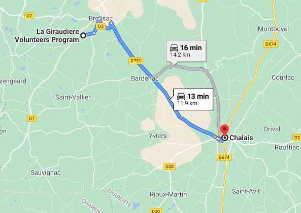
Chalais is a ville, or town, in The Charente department of the nouvelle Aquitaine region. Chalais has a chateau which overlooks the town and its river. Chalais is located 12.9 km south of La Giraudiere.
It is the southernmost town in the Charente with over 1,000 people. It lies along the river Tude and is only 12 km from La Giraudiere. Here you will find an interactive map and also a map showing the distances from La Giraudiere.
Maps Chalais en Charente France
These maps and webpages have been produced and put in place by volunteers and interns who have taken part in the different programs at La Giraudiere. At the top of this page, you will find links to our different programs and how to contact us and links for more information about us. If you are looking for a new way to experience France then for sure we can oblige.